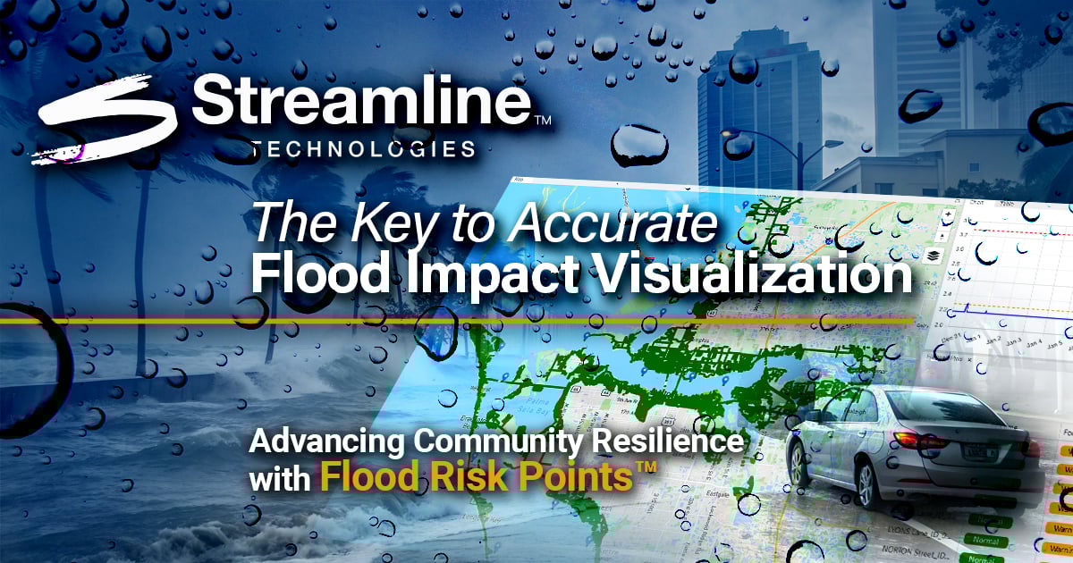
Discover how Streamline Technologies’ FloodWise™ system and Flood Risk Points™ deliver unprecedented, real-time, asset-level flood intelligence that empowers municipalities, key decision-makers, and emergency response teams to prepare, respond, and recover with precision.
With storms growing in both frequency and intensity, municipalities, key decision-makers, and emergency management teams can no longer rely solely on broad regional forecasts or long-term flood zone maps. Today’s emergency responders, public works teams, and local leaders require precise, real-time intelligence that identifies not only whether flooding will occur, but exactly where it will strike and how deeply it will impact specific locations.
Streamline Technologies’ FloodWise™ system and Flood Risk Point™ (FRP) technology deliver this level of clarity, setting a new standard for actionable flood intelligence.
From Probability to Precision
Traditional Federal Emergency Management Agency (FEMA) flood maps remain essential for understanding long-term flood probability but were never designed for real-time decision-making or to answer operational questions such as which streets will flood tomorrow, whether a vulnerable neighborhood will be cut off, or which critical facility could face water intrusion, risking loss of access.
Flood Risk Points™ fill this critical gap by visualizing forecasted flood depths at precise, real-world locations such as streets, homes, lift stations, health facilities, law enforcement and fire stations, schools, and other critical infrastructure. This shift from zone-based mapping to asset-level forecasting transforms preparedness, response, and recovery, creating a level of real-time situational awareness in flood management like never before.
AI-Enhanced Asset Identification for Unmatched Accuracy
At Streamline Technologies, we leverage Flood Risk Points™ to visualize flooding impacts at the street, house, and critical infrastructure level several days in advance of an approaching storm event. Utilizing AI and deep learning, we extract building footprints from high-resolution imagery and integrate them into the StormWise™ hydrologic and hydraulic (H&H) model network.
We’re also advancing deep learning techniques to map roads, bridges, culverts, utilities, and other essential structures using LiDAR point clouds and high-resolution imagery. This rapidly expanding dataset forms the backbone of the FloodWise™ system, continually improving the precision of flood impact visualization.
Collaboration with leading AI partners allows us to continue the refinement and enhancement of our QA/QC processes, ensuring that every Flood Risk Point™ reflects dependable, up-to-date intelligence. This fusion of continuous model refinement, high-resolution geospatial data, and sophisticated AI-based validation provides FloodWise™ customers with a level of accuracy and reliability that is unmatched in today’s flood forecasting landscape.
Transforming Insight into Informed Decision Making
FloodWise™, Streamline Technologies’ real-time flood forecasting and early warning system, operates continuously, automatically retrieving forecasted rainfall data in one-hour increments and updating forecasted flood levels several days in advance.
Its flexible model architecture allows StormWise™, SWMM, HEC-RAS, and other existing models to be integrated seamlessly, allowing users to leverage existing models while gaining access to powerful real-time forecasting. Integrated NOAA coastal forecasts support compound flooding scenarios, and the system’s “what if” simulation capabilities allow teams to explore alternate rainfall patterns, infrastructure changes, and operational strategies directly from the FloodWise™ dashboard.
When paired with FloodWise™, Flood Risk Points™ convert forecast data into strategic decision-making. Emergency managers gain the ability to identify which roads will be cut off, which buildings require early outreach, and where to pre-position barricades, pumps, or rescue resources. Public works teams can prioritize at-risk utilities, while local governments can communicate targeted warnings to residents well in advance of anticipated flooding impacts.
By shifting from reactive response to proactive preparation, this level of foresight not only reduces disruption and property damage but also protects lives and critical resources.
Supporting Faster, Smarter Recovery
The value of Flood Risk Points™ also continues well beyond the storm.
By comparing forecasted vs observed conditions, users can rapidly prioritize inspections, document infrastructure impacts, refine modeling assumptions, and strengthen future mitigation strategies. In turn, FRPs support a more efficient and informed recovery process, enabling local leaders and key decision-makers to make data-driven decisions that strengthen future forecasts and inform long-term infrastructure improvements, thus enhancing long-term resiliency.
Delivering a Smarter, Safer Future Through Precision Flood Intelligence
As storm events grow in both frequency and intensity, communities will continue to face the increasing challenges posed by flood events…. But uncertainty no longer has to define response.
Through the integration of high-resolution geospatial data, advanced AI, deep learning, and continuous real-time modeling, Streamline Technologies’ FloodWise™ system and Flood Risk Points™ offer the clarity needed to forecast impacts with unmatched precision.
From preparation to recovery, FloodWise™ empowers municipalities, key decision-makers, and emergency management teams with precise, actionable flood intelligence to anticipate, adapt, and respond decisively, strengthening resilience and safeguarding the people they serve one informed decision at a time.
Contact our team to learn how Streamline Technologies’ FloodWise™ system and Flood Risk Points™ provide unmatched, real-time flood intelligence that empowers municipalities, key decision-makers, and emergency management teams to anticipate impacts and act with confidence.
TAGS
Blogs