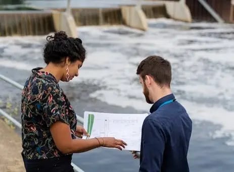
StormWise™ for Resiliency and Sustainability

Creative Solutions for Complex Systems
StormWise™ (formerly ICPR4) is a hydrologic and hydraulic modeling software that has aided engineering professionals with identifying flood risks and floodplains, modeling flood scenarios, reducing construction costs, better planning and decision-making, and compliant stormwater management.
Modeling
StormWise™ offers flexible and scalable modeling systems. Models include 1D H&H (hydrologic and hydraulic) and fully integrated 2D surface water and groundwater flow, with an emphasis on interactions between surficial aquifer systems and surface water bodies.
1D Surface Flow
Enhance engineering efficiency with optimized 1D flow analysis and a “Link-Node” model approach. Features include strategic nodes, versatile simulations, expedited construction, and automated tools.
2D Overland Flow
Advanced computations leverage the finite volume method, automated flexible mesh generation, full integration with 1D surface flow, and ensure precise drainage analysis through rain-on-grid techniques.
2D Groundwater
StormWise™ employs the finite element method to accurately compute heads, horizontal flow, seepage, and leakage. Interaction with surface water is facilitated by intersecting computational meshes.
Stormwater management teams are tied to strict governmental regulations, out of necessity. With StormWise™, engineering professionals can:
- Meet compliance requirements
- Gain a competitive business advantage when bidding on projects with stringent environmental standards
- Avoid resource constraints, operational restrictions, and project delays
Models from Maps
StormWise™ excels via georeferenced graphics: automated data takeoff from maps including multi-layered thematic map intersections.
Flexible Mesh
StormWise’s 2D computational framework: adaptive mesh, rain-on-grid including infiltration, integrated 1D-2D surface flow, streamlined modeling.
Graphical Elements
Extensive and diverse georeferenced graphical toolset, customizable 2D mesh.
Water Surface Profiles
Animate water profiles on user-defined 1D paths with simulation playback.
Animations
StormWise™ offers diverse 2D result animations: flood extents, velocity vectors, manual or timed viewing, and export raster-based results from the animation panel.
Groundwater Results
Diverse groundwater reports and visuals: retention pond storage recovery, riverine interactions, groundwater mounding.
Version Comparison
Streamline Technologies offers different versions of StormWise™ for various stormwater modeling needs.
Current Version: 4.08.08
We encourage you to visit the FAQs on our support page for information on minimum system requirements, how you can optimize your simulation run times, and more!
StormWise™ Pro
Ready to Purchase
- Interconnected Ponds
- Complex Drainage Systems
- Automated Data Takeoff
StormWise™ Expert
Ready to Purchase
- Integrated 1D & 2D Surface Flow
- Integrated Surface Water & Groundwater
- Flood Animations & Flexible Mesh
StormWise Pro
StormWise Expert
1D H&H Modeling
2D Overland Flow Modeling
2D Groundwater Modeling
Unlimited number of nodes, links, and basins
Allows lumped or distributed approach for basin hydrology computations
Allows Curve Number, Green-Ampt, or Vertical Layer rain excess methods
Single event simulation
Continuous simulation including evapotranspiration and soil moisture tracking
Includes all graphical capabilities of StormWise™ including automated data takeoff with map layers
Customizable Reports & Quick Reports
Animated 1D Water Surface Profiles
Graphic View Animation
Includes software updates
Includes expert technical support
Accredited Excellence for Unmatched Value
- Virginia Tech
- Florida Gulf Coast University
- University of South Carolina
- Ocean Circulation Lab, College of Marine Sciences at the University of South Florida
- Embry-Riddle Aeronautical University
- University of Georgia – Institute for Resilient Infrastructure Systems
StormWise™ Pro (1D version) is accepted by:
StormWise™ Expert (1D/2D version) is accepted by FEMA for:
- the State of Florida
- the City of Lubbock, Texas
- Georgetown County, South Carolina
- the City of Lafayette, Indiana
- the City of Chesterfield, Missouri
Our Affiliations
-
“Our office has been using the StormWise software for many years to support our stormwater designs and watershed studies. I love the graphic interface in StormWise that allows for the use of our actual basin limits and grading surfaces. The staff at Streamline has always been very responsive whenever I have questions or issues with one of my stormwater models.”
 Lara Bartholomew, PE, ENV-SP Senior Project Engineer at Ardurra
 -
“StormWise is a standard in the industry. It’s become an even more powerful tool, particularly with the addition of groundwater and mapping functionality. It is one of the most intuitive models in terms of ease of use. StormWise is very versatile and can be used by seasoned modelers, those that are new to H&H modeling, and everyone in between.”
 Elizabeth Perez, PE, D.WRE, CRM, President of Collective Water Resources, LLC
 -
"StormWise has been an essential tool for supporting more than 35 of the stormwater master plans and watershed management plans that we have worked on in Florida. The integration with GIS and support for 2D surface and groundwater modeling and long-term simulations make StormWise one of our go-to modeling platforms.
 Justin H. Gregory, PE Senior Manager / Vice President of Jones Edmunds
Workshops
Sign up for one of our upcoming workshops for a step-by-step training on theory, use, and practical application of StormWise™ (formerly ICPR4). Attendees of our workshops will receive:
- Personalized instruction
- Extensive course materials
- In-depth modeling concepts
- 12 Continuing Education Credits for Certified Floodplain Managers
- 21 PDHs for Professional Engineers
Seats are limited, so register now!

Complex Water Problems Made Easy
Interested in how StormWise™ can easily solve complex stormwater management problems? Request a demo!


