Explore how accurate flood maps, advanced modeling tools like StormWise, and data-driven insights help communities assess risk, guide development, and build resilience against flooding.
Floods are among the most common and unpredictable natural disasters. They can occur anywhere, anytime, and are influenced by a wide range of factors, from coastal surges and river overflows to heavy rainfall and our ever-changing landscape. But how do communities understand their flood risk? And how do engineers, planners, and local governments use data to make smarter, safer decisions?
The answer lies in floodplain maps: critical tools that help identify high-risk zones, guide building practices, and shape insurance requirements. But behind every accurate floodplain map and informed floodplain decision is a deeper layer of science and technology.
What Is a Floodplain Map, and Why Does It Matter?
A Floodplain Map or Flood Insurance Rate Map (FIRM) developed by the Federal Emergency Management Agency (FEMA) serves multiple purposes.
They identify areas with varying degrees of flood risk and inform decisions about land use, construction, infrastructure, and insurance requirements. Floodplain maps guide communities in setting appropriate building codes and help residents understand their exposure.
Key functions of a Floodplain Map include:
- Supporting compliance with the National Flood Insurance Program (NFIP)
- Identifying Special Flood Hazard Areas (SFHAs) zones as part of the NFIP
- Establishing insurance rates and mandatory coverage zones
- Informing local planning and floodplain management standards
- Guiding resilient infrastructure development and emergency preparedness
These maps are regularly updated based on new data, improved science, and changes in land use, topography, and climate patterns.
Interpreting Flood Zones
Floodplain maps classify areas into zones based on their risk level. These designations are used to determine flood insurance requirements, building standards, and potential exposure.
- High-risk zones (A, AE, AH, AO, AR, A99, V, VE): Located within the 100-year floodplain. These areas are subject to mandatory flood insurance requirements for properties with federally backed mortgages.
- Moderate-risk zones (B, shaded X): Outside the high-risk areas but still vulnerable, particularly during major weather events.
- Minimal-risk zones (C, unshaded X): Areas with the lowest risk, though not entirely without flood potential.
- Zone D: Areas where flood hazards are possible but have not been studied.
FEMA’s flood zones are based on the 1% annual chance flood event, also known as the 100-year flood. But they aren’t static. As populations grow, weather patterns shift, and infrastructure evolves, floodplain maps must be updated using the most advanced modeling tools available.
More importantly, approximately 20% of NFIP claims come from properties located outside of Special Flood Hazard Areas (SFHAs) zones, underscoring that there is no such thing as a no-risk zone.
The Challenge: Changing Risk, Complex Terrain, and Limited Resources
Floodplain maps are vital for decision-making at every level. Municipalities use them to plan growth, reduce flood-related damage, and meet regulatory requirements. Mortgage lenders consult FIRMs to determine if insurance is required. Property owners use them to assess their risk and protect their investment.
Floods don’t take into account city limits or property boundaries. Yet many communities struggle to keep their flood data current. Why?
- Outdated or incomplete watershed studies
- Rapid development that alters runoff patterns
- Increasingly severe weather from shifting climate patterns
- Budgetary constraints limiting access to modeling expertise
But accurate flood modeling isn’t just a regulatory requirement, it’s an essential part of building resilient communities.
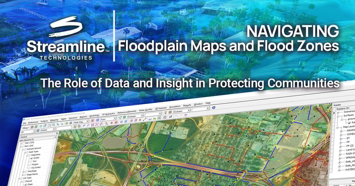
StormWise™: Modeling Flood Risk with Precision and Purpose
For over 40 years, StormWise, Streamline Technologies’ comprehensive hydrologic and hydraulic (H&H) modeling software has empowered engineering professionals, agencies, and municipalities to assess, model, and mitigate flood risk.
StormWise enables users to simulate stormwater runoff, streamflow, and floodplain dynamics across a range of conditions. The software is trusted by local governments, consultants, and federal agencies to support effective floodplain mapping, stormwater design, and risk management.
StormWise supports:
- Floodplain mapping through accurate watershed and riverine modeling
- Regulatory compliance with NFIP and local stormwater management standards
- Planning and scenario analysis for resilient infrastructure and development
- Cost-effective design through optimization of detention, conveyance, and mitigation systems
- Evaluation of compound flooding involving rainfall, tidal surge, and backwater effects
- And more
Stormwater management teams are also tied to strict governmental regulations. With StormWise, engineering professionals can:
- Meet compliance requirements
- Gain a competitive business advantage when bidding on projects with stringent environmental standards
- Avoid resource constraints, operational restrictions, and project delays
By modeling various conditions and storm events, StormWise empowers professionals to visualize and manage flood risk with confidence.
StormWise Pro (1D version) is nationally accepted by FEMA for NFIP purposes. Furthermore, StormWise Expert (1D/2D version) is also FEMA-accepted and approved for use by several jurisdictions, including the State of Florida, Lubbock, Texas, Georgetown County, South Carolina, Lafayette, Indiana, and Chesterfield, Missouri.
Innovation Solutions for Increased Resiliency & Sustainability
Floodplain maps are more than regulatory tools, they are essential guides for building safer, smarter, and more resilient communities. Accurate flood risk identification requires more than historical data; it demands sophisticated modeling tools such as StormWise that reflect current and future conditions.
As climate patterns continue to shift and communities expand, having access to reliable hydrologic and hydraulic modeling solutions is not just beneficial, it’s essential. StormWise continues to help engineers, planners, and policymakers stay ahead of the risk, ensuring smarter development, informed decisions, and better protection for generations to come.
Contact our team today to learn more about StormWise and how it can support with identifying flood risks and floodplains, modeling flood scenarios, reducing construction costs, better planning and decision-making, and compliant stormwater management.
TAGS
Blogs